The Province of Huelva does not have a single signature landscape. At one end are tidal marshes and sandy Atlantic shores; at the other, wooded valleys and rocky ridges. Between them lies a mining district whose exposed rock and iron-rich waters seem to belong to another planet. A good nature itinerary chooses a habitat rather than trying to fit the whole province into one rushed day.
These are places to experience, not promises of particular wildlife sightings. Natural areas change with rainfall, tides, heat, restoration work and conservation restrictions. Bring suitable footwear, carry water and check official visitor information—especially before entering protected wetlands or attempting a remote trail.
Marismas del Odiel: birds, salt pans and a changing estuary
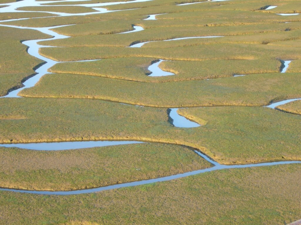
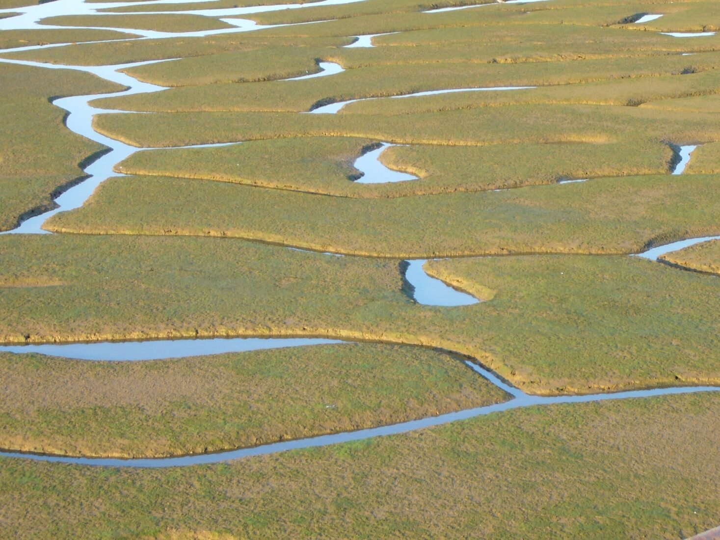
Close to Huelva, the Odiel marshes are one of the most accessible ways to understand the landscape where the Tinto and Odiel meet the Atlantic. Instead of one continuous sheet of water, the area contains tidal channels, mudflats, salt pans and islands; birds exploit different parts of it at different times.
Start with the Anastasio Senra visitor-centre area and its authorised routes or observatories. A pair of binoculars makes a bigger difference here than an expensive camera. Quiet observation is more rewarding than trying to cover as many kilometres as possible.
Access: Use marked public routes and current visitor-centre guidance. Some sensitive sectors are restricted or require guided access. The marshes are a protected landscape, not an open driving circuit.
La Rocina: a gentle way into Doñana
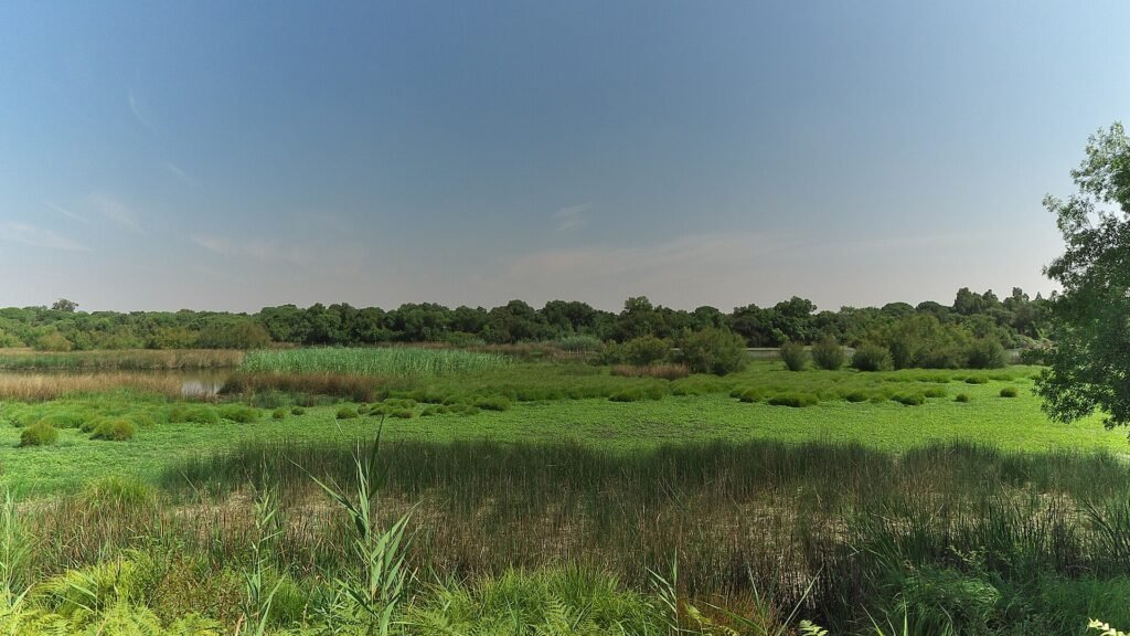
The La Rocina visitor centre near El Rocío offers a wetland experience that does not depend on purchasing a lengthy guided tour into Doñana’s more restricted interior. Its trails and observation points help visitors notice the relationship between water, vegetation and birdlife.
Visit with patience: a small movement in the reeds or an unfamiliar call may be more memorable than the broad scenery. Water levels and the species visible change with season and weather.
Access: La Rocina is one of the visitor locations reachable on foot from El Rocío. Check current trail conditions; do not wander beyond signed access points.
Sierra de Aracena and Picos de Aroche: a green inland contrast
The mountain country in northern Huelva is a world of oak woodland, chestnut groves, pasture, stone paths and small villages. There is no need to chase the highest viewpoint: an old village-to-village route can reveal streams, agricultural terraces and the changing relationship between woodland and grazing land.
Choose an official signed trail according to your fitness, the weather and whether it is linear or circular. A modest distance may include climbs and uneven stone surfaces. Combining a half-day walk with an unhurried lunch in a village is often more realistic than attempting several separate trails.
Access: Start from a named official trailhead, carry offline mapping and respect livestock, gates and private property. Some paths may become slippery after rain.
Enebrales de Punta Umbría: dunes with living roots
Behind part of the coast near Punta Umbría, junipers, savin junipers and other vegetation help stabilise dune systems. This is not empty land between the road and the beach; it is a fragile habitat in its own right.
Use established boardwalks or signed paths rather than cutting across the dunes. Notice how plants differ between exposed sandy ground and sheltered areas farther inland. A short walk can reveal more ecological detail than an hour of crossing hot sand.
Access: Stay on marked approaches to the shore and keep dogs under any applicable local restrictions. Beach facilities vary by section and season.
Laguna de El Portil: freshwater near the sea
The Laguna de El Portil is an interesting stop because it sits near a heavily visited coastal zone but supports a very different environment from the open beach. The lagoon and surrounding vegetation attract birds and reward visitors who enjoy watching a landscape change through the seasons.
Its water and visible birdlife are not constant. A dry or quiet-looking visit does not mean the reserve has failed; wetlands naturally vary, and water levels depend on climatic conditions.
Access: Find official observation areas and respect any closed sections. Combine this with the El Portil area only if you have allowed time to appreciate the quieter nature stop.
Flecha de El Rompido: a sand spit shaped by the river
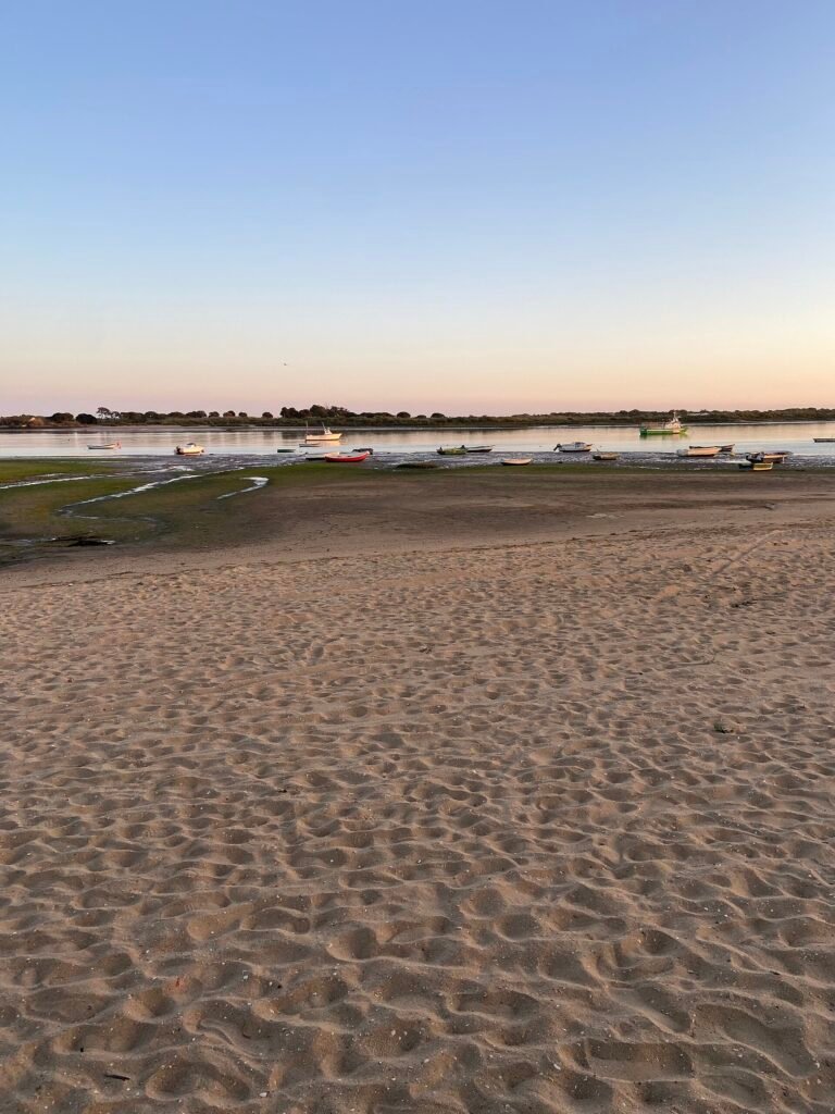
At the mouth of the Río Piedras, the Flecha de El Rompido forms a long, narrow barrier between the estuary and the Atlantic. Its appeal lies in understanding an active coastal process: wind, waves and sediment continually shape a landscape that may look deceptively static from the shore.
You can appreciate the spit from El Rompido without crossing the water. Seasonal boat services, when operating, may provide access to designated beach areas on the far side, but this is not a place for unsupervised swimming across a channel.
Access: Confirm whether crossings are operating and how return trips work. Respect currents, changing tides and protected dunes.
Acantilado del Asperillo: colour and geology above the Atlantic
Near the eastern coast, the cliffs known as Acantilado del Asperillo reveal layered sands whose colours make the seaward edge of the landscape particularly striking. The surroundings include pinewoods and dune formations associated with the Doñana natural area.
Appreciate the cliffs from designated paths or safe viewpoints. The attraction is the geology and open coastal setting, not approaching an unstable edge for a photograph.
Access: Confirm current status of the Cuesta Maneli route or any other trail you intend to use. Coastal erosion and conservation works can affect access.
Río Tinto mining landscape: nature and industry intertwined
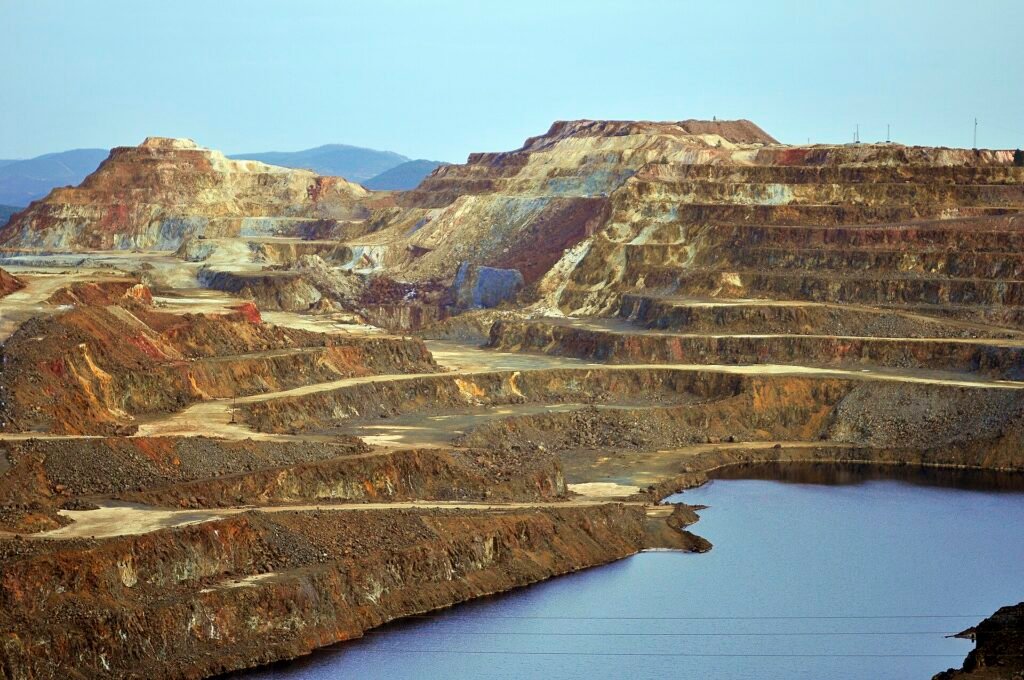
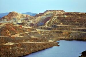
In the inland mining basin, iron-rich and acidic waters help create the famous colours of the Río Tinto. The landscape also bears the unmistakable marks of centuries of extraction: cuts in the hillsides, railways and exposed deposits. Its appeal is partly geological and partly industrial, which makes it very different from a protected forest or wetland.
The Río Tinto Mining Park operates structured visits to specific attractions, including railway heritage and mines. Seeing them with appropriate interpretation is far more informative—and safer—than driving onto tracks or mining property to look for a dramatic panorama.
Access: Follow the mine operator’s current route and ticket conditions. Do not enter abandoned workings or touch unfamiliar mine water and deposits.
Choosing a nature day that suits you
Birdwatching without a long drive: Choose Marismas del Odiel. Quiet paths and wetlands: Choose La Rocina. Woodland walking: Visit the Sierra de Aracena. Coastal geology: Research access to Asperillo. Unusual industrial landforms: Plan a booked Río Tinto visit.
A car offers flexibility, but it does not grant access to protected roads. For families with small children or visitors with limited mobility, ask operators about the actual path surfaces and distances rather than relying on generic “easy” labels. In summer, avoid treating midday as the best time for exposed trails and dunes.