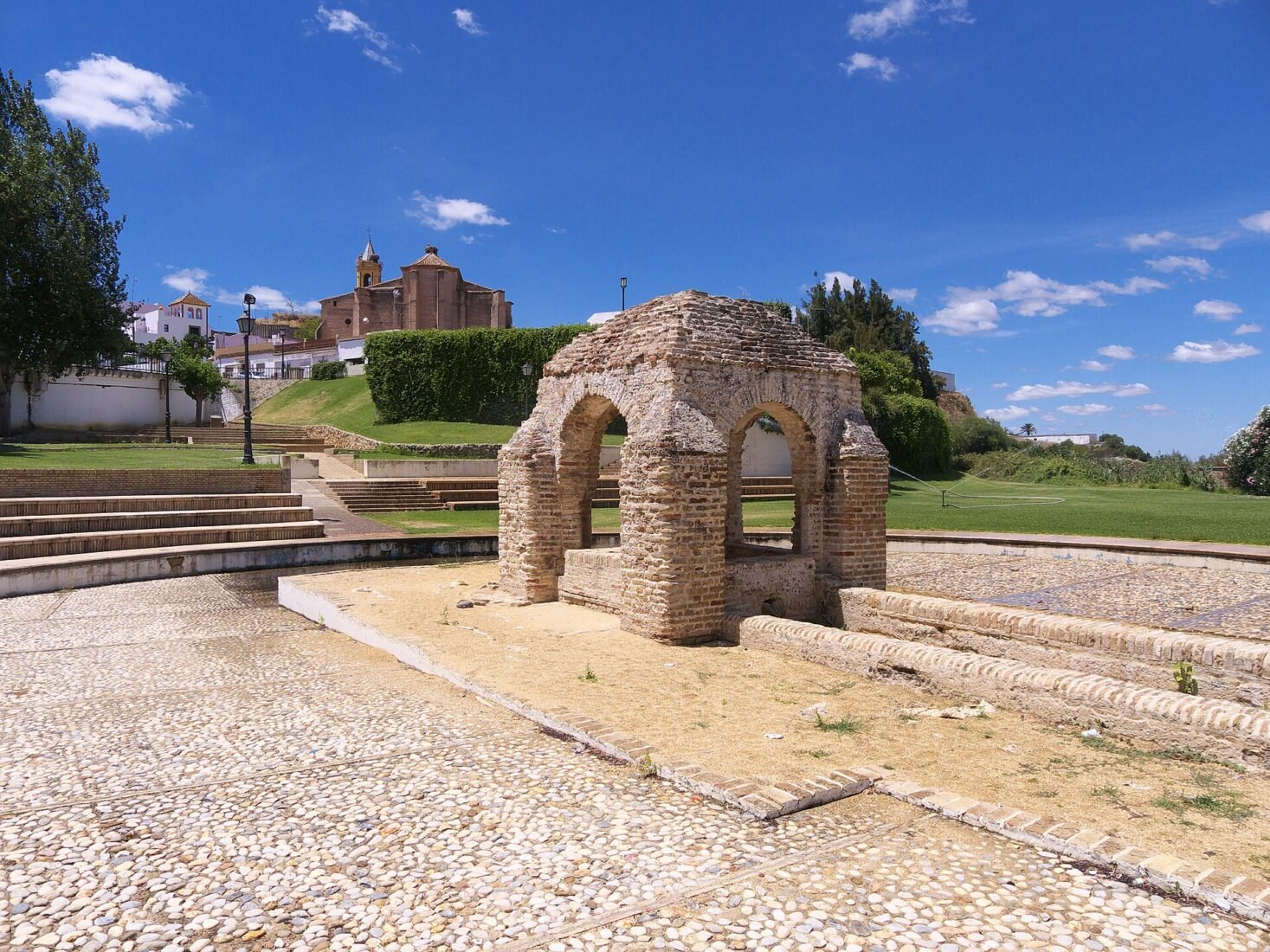
Palos de la Frontera is often introduced through a single date: 3 August 1492, when three ships departed from its port on the voyage led by Christopher Columbus. That history matters, but it is more interesting when you look at the town itself: the church where sailors gathered, a small fountain near the former waterfront, and the buildings associated with the local seafaring families who helped make the expedition possible.
This is not a place where every attraction sits behind a ticket gate. Much of the appeal is in following a compact historic circuit and using the landscape to imagine how a working port town once functioned. The old harbour no longer looks like a harbour, and that change is part of the story. Beyond the centre, the municipality also includes La Rábida’s heritage sites and a coastal sector around Mazagón; both require a separate leg of your visit.
1. Start at Iglesia de San Jorge Mártir
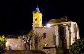
The Church of Saint George is a sensible first stop because it connects architecture with the town’s maritime past. Its brickwork, Gothic and Mudéjar details, and later restorations tell a longer story than the events of 1492 alone. Outside, find the Puerta de los Novios, traditionally linked to the sailors who went down towards the port before the expedition departed.
Do not overlook the other doorway, sometimes called Puerta de América, or the changes in the bell tower following the eighteenth-century earthquake. The building is still a church, not a permanently open museum: the municipal tourism service says entry is possible during worship or as part of a prearranged guided visit. Check before making the interior the centrepiece of your morning.
2. Find La Fontanilla and imagine the old port
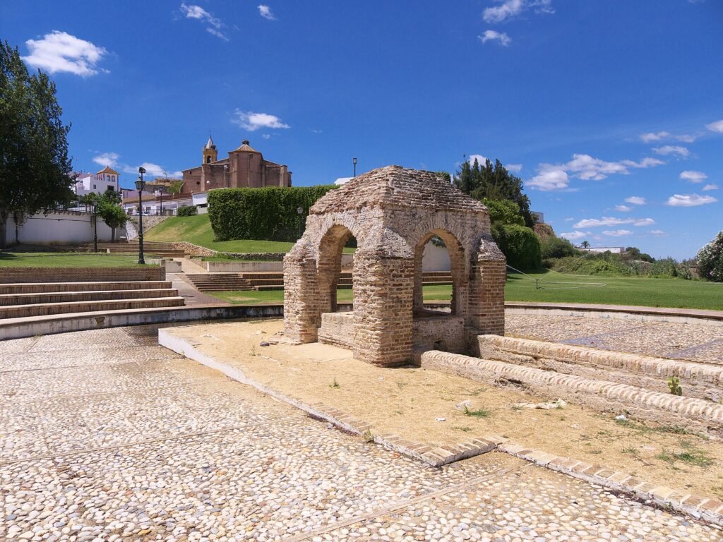
A short distance from San Jorge stands La Fontanilla, a brick-built medieval fountain under a small roofed structure. Local tradition links it to the water taken aboard ships leaving the port. It is modest in size, and precisely for that reason it helps put the scale of everyday life into the larger story of Atlantic exploration.
Look at its arched form rather than expecting a functioning fountain or large exhibition. The former waterfront ran through this area, but the landscape and waterways have changed over the centuries. You will not find three historic ships moored at the original departure point. That contrast between the surviving fountain and the vanished harbour is worth thinking about before moving on.
3. Visit the Casa Museo Martín Alonso Pinzón
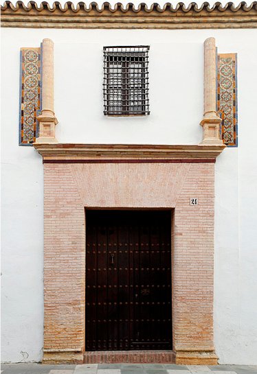
The Pinzón family helped organise and navigate the 1492 expedition, and their restored family house makes that involvement more personal. The house museum on Calle Cristóbal Colón presents period-style spaces, material about the family and the maritime setting of the town. The building itself preserves aspects of its older structure, although its present appearance includes subsequent alterations.
Rather than seeing Martín Alonso Pinzón only as a name attached to the Pinta, use the visit to consider the skills, resources and local networks required to equip a voyage. Municipal tourism information publishes seasonal visiting arrangements, but these should be checked with the tourism office, especially on Sundays, holidays or when a guided group is using the building.
4. Understand the sailors’ working lives at the Museo Naval
Nearby, the Museo Naval Vicente Yáñez Pinzón occupies a former sailors’ hospital, the Hospital de la Misericordia. Its original purpose makes it a particularly fitting setting for maritime history: seafaring involved injuries, illness, risk and the institutions that supported the men who travelled.
The museum is a useful companion to the family house rather than an interchangeable second stop. One introduces the Pinzón household; the other broadens the picture to navigation, maritime life and the settlement’s relationship with the sea. Check with the local tourism office for actual opening and guided-visit availability instead of assuming you can enter at any time.
5. Look over the historic port area from the castle viewpoint
The castle site and its viewpoint are important because they help visitors read the topography. Palos developed above an inlet connected with the lower Río Tinto, and the former port was close to the church and fountain. Later changes to the estuary left that maritime setting less obvious than the phrase “historic port” might suggest.
Use the viewpoint to orient yourself, not to search for intact medieval docks. If archaeological remains or a section of the site is fenced off, respect the barrier and enjoy the landscape from the public space. The surrounding streets can be uneven, so a little extra time and appropriate footwear are more useful than a rigid minute-by-minute route.
6. See the Pinzón monuments and the civic centre
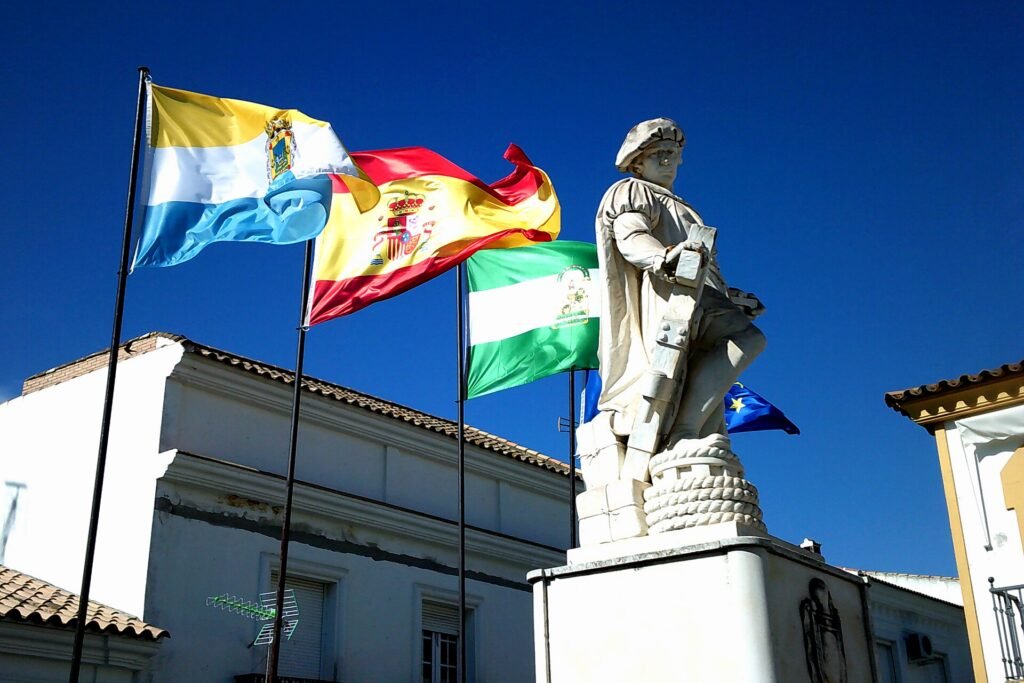
The town’s public squares and monuments show how Palos has remembered its navigators over many generations. A sculpture of Martín Alonso Pinzón is a useful stop between the older buildings, and the municipal centre offers an opportunity to notice the town as a living place rather than only a collection of memorials.
Look at the inscriptions and commemorative imagery with a little curiosity. Public monuments were erected long after the historical events they depict and reflect the priorities of their own time. The voyages opened sustained contact across the Atlantic, but also led to conquest, displacement and profound harm to Indigenous peoples. Remembering both dimensions gives more meaning to the visit.
7. Use a guided walk to connect the landmarks
The tourist office offers information on guided visits taking in the Pinzón house, naval museum, San Jorge, La Fontanilla and the former port area. This is a good option if you want the geography explained rather than having to reconstruct it from separate plaques.
Ask the office on Calle Rábida about the current route, language availability, meeting point and any use of virtual-reality interpretation. Availability should be confirmed rather than assumed. Independent walkers can still follow the public streets and stop at the exterior of each monument when a museum is closed.
8. Allow a separate visit for La Rábida
La Rábida is within the same municipality but is not part of the compact town-centre walk. Its Franciscan monastery, Muelle de las Carabelas and gardens deserve their own time, especially if you want to go inside the monastery and explore the full replica-ship complex.
The monastery was connected to Columbus’s preparations for the voyage; the replicas at the nearby museum are modern reconstructions, not surviving ships from 1492. Visitors particularly interested in those two sites should arrange their trip around official visiting schedules rather than trying to squeeze both into an unplanned detour.
9. Enjoy a different landscape at the José Celestino Mutis Botanical Park
For a change from churches and historic monuments, the botanical park at La Rábida brings together plants associated with Iberia and the Americas. It commemorates the eighteenth-century botanist José Celestino Mutis and offers an open-air setting for a slower walk.
Entry to the park is free according to the provincial authority. The greenhouse is currently listed as closed for maintenance until further notice, so plan primarily for the outdoor gardens and check the official park page for updates. This is especially pleasant when your main interest is a break between more concentrated museum visits.
10. If you have extra time, see the Mazagón waterfront
Mazagón is not a separate municipality: the locality and coastal surroundings extend across Palos de la Frontera and neighbouring Moguer. On the Palos side, the marina and waterfront provide a very different picture of maritime life from the medieval port in the historic centre.
A stroll around the marina can round out a heritage-focused day, particularly if you are already travelling by car. Do not confuse this modern recreational harbour with the original port of 1492. Beach access, tidal conditions, parking and seasonal services differ from one stretch of coast to another, so decide on a particular destination before setting off.
How to plan your visit
Half a day in the town: Begin at San Jorge and La Fontanilla, then explore the Pinzón house and Naval Museum if they are open. Finish with the castle viewpoint and a walk around the centre. This makes a logical historical circuit without treating each monument as a long museum visit.
A fuller day: Add La Rábida and the botanical park after the town. A car or arranged transport makes the transfer easier; check bus options independently rather than assuming a frequent direct connection between every attraction. The coastline around Mazagón is best kept as an optional addition.
Accessibility and timing: Streets around the older landmarks may be uneven and some heritage buildings have restricted access. Verify the exact interior route with each operator. Allow extra time if you are visiting on a religious holiday or during a local festival; do not depend on yesterday’s museum schedule.