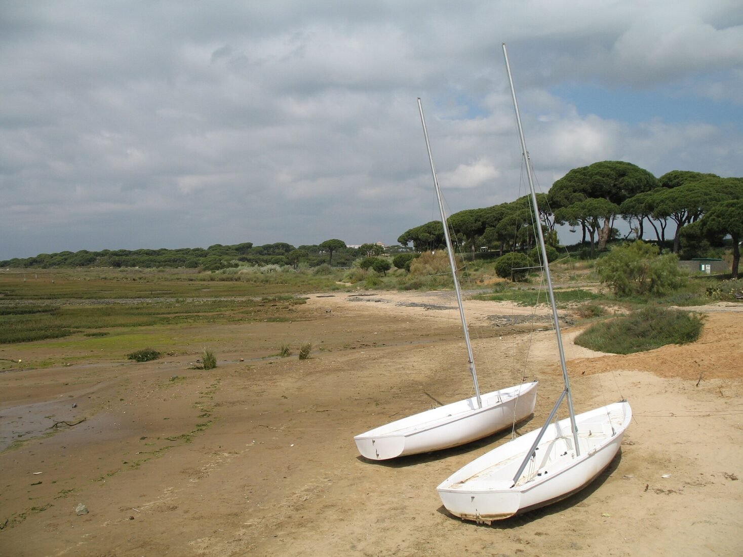
Cartaya’s natural landscape is not a single beach or a single forest. The lower Río Piedras opens into channels and marshes, the coastal dunes shelter fragile plants, and extensive pinewoods reach inland. The most satisfying way to explore the area is to choose a route that suits your day: an accessible introductory stretch, a marshland walk, a short botanical path or a longer outing beneath the pines.
This guide focuses on walking locations and viewpoints linked to Cartaya municipality, including El Rompido and Nuevo Portil. The protected Marismas del Río Piedras y Flecha del Rompido area extends into neighbouring Lepe, so a landscape name should not be mistaken for one municipality’s boundary. Official trail distances are useful planning figures, but path closures, flooding and condition changes must always be checked locally.
1. Sendero Río Piedras: a practical introduction to the estuary
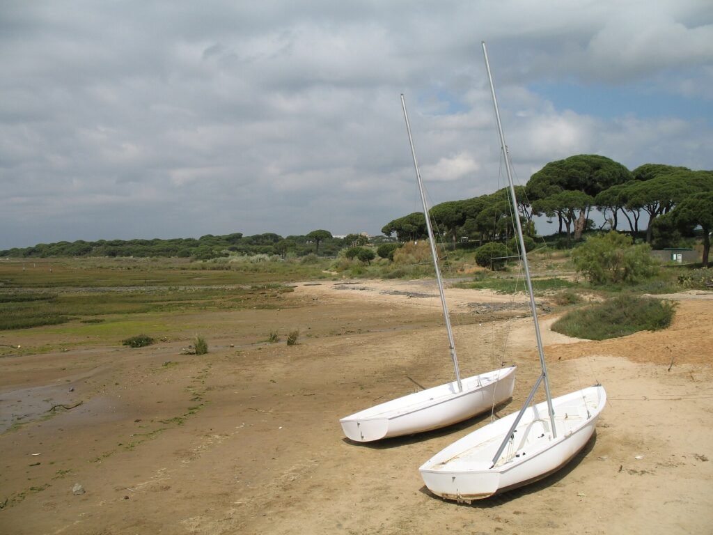
This is one of the most useful walks for a first-time visitor because it combines several habitats in a compact route. Beginning near the parking area by the El Rompido lighthouse, the trail follows parts of the riverbank and threads through pine vegetation. Along the way, viewpoints take in the harbour, tidal channels and the long sandspit beyond.
The town council lists the route as approximately four kilometres and low difficulty. Its initial portion has been adapted to improve access for visitors with reduced mobility, with resting areas along that section. Practical tip: Do not assume the whole loop has the same adapted surface. Take binoculars, avoid shortcutting across muddy ground and check conditions before starting.
2. Sendero de las Turberas del Lancón: from pines to wetlands
The Turberas del Lancón path offers a change of scenery within the same general estuary landscape. Rather than keeping to open shore views throughout, it enters woodland with stone pines, rosemary and mastic shrubs before approaching the peatland area that gives the walk its name.
The Cartaya tourism information describes a circular route of about 4.5 kilometres with low difficulty. It can be linked with other local trails, but longer combinations are not necessary to appreciate the setting. Practical tip: Choose a dry, suitable day and use the signposted route. After rain, paths near wetlands may be muddy. The forest has shade in places, but not every section is sheltered.
3. Sendero Marismas de San Miguel: see the tidal channels close up
If your main interest is the marsh itself, the San Miguel path is more specialised. It follows open wetland where tidal creeks, salt-tolerant plants and birds are the principal sights. The route lets walkers understand why mud, water and salt shape this place so strongly.
Municipal information describes a low-difficulty circuit of roughly 1.7 kilometres, involving wooden crossings of smaller channels. Practical tip: There is little shade, so bring sun protection and avoid the hottest part of the day in summer. Watch the surfaces carefully after rain or flooding, and turn back if water or damage affects a crossing.
4. Sendero Botánico del Caño de la Culata: learn the dune plants
On the Nuevo Portil coast, a botanical itinerary connects the beach environment with its characteristic vegetation. The council’s route description highlights species such as stone pine, juniper, mastic, dwarf palm and dune grasses, with interpretation panels to help visitors recognise them.
The signposted walk is described as about two kilometres. It combines sections alongside the coast with a wooden boardwalk across dune terrain. Practical tip: Move at a reading pace rather than treating it as a workout. The boardwalk and marked route help protect plants whose roots stabilise sandy ground. Seasonal beach access or maintenance work may affect the path.
5. Pinares de Cartaya: a woodland alternative to the beach
The municipality’s broad stone-pine woodland, known locally as the Pinares de Cartaya or Campo Común, is easy to overlook when the coast is the main attraction. Municipal sources describe a large connected landscape with Mediterranean undergrowth, areas used traditionally by local communities and marked recreational routes.
It is not one compact nature park with a single obvious entrance. Some tracks are intended for different uses and may pass forestry or agricultural land. Practical tip: Pick a specific official walking route before arriving. During high fire-risk periods, restrictions can change, and open flames should never be assumed permissible. Carry water even for short walks.
6. Playa de San Miguel: the meeting of pines and sand
Playa de San Miguel sits between El Rompido and Nuevo Portil. It is a useful choice when you want to combine a walk beneath coastal pines with a stretch of beach, without committing to a boat trip across the river. The landscape contrasts with the sheltered harbour frontage of El Rompido.
The beach has seasonal visitor facilities, but their availability is not fixed year-round. Practical tip: Check the official beach information before travelling for accessible equipment or lifeguards. Pay attention to sea conditions, tidal movement and flagged warnings, particularly if you plan to enter the water.
7. Viewpoints around El Rompido and Nuevo Portil
The view from a headland or riverside viewpoint can explain the landscape more quickly than a long walk. Look towards the river mouth from the El Rompido lighthouse area, then compare it with the outlooks near San Miguel and Nuevo Portil. At different tides, the channels and banks appear to redraw themselves.
For photographers, the useful subject is often the relationship between the village, estuary, marsh and sandspit rather than one isolated object. Practical tip: Stay behind barriers and on public trails, particularly near eroding edges or dunes. A strong coastal wind can make exposed viewpoints less comfortable than the temperature suggests.
8. The Flecha del Rompido: a protected sandspit reached by boat
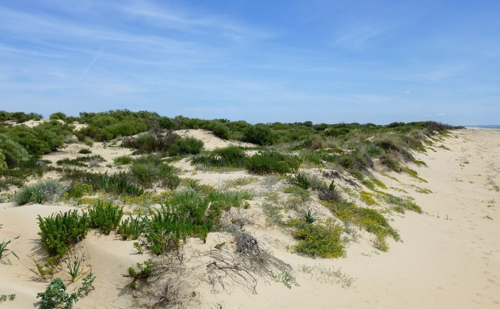
The sandspit on the far side of the estuary is a striking natural feature, with Atlantic-facing beach, dunes and vegetation adapted to sandy ground. It sits within a protected area extending across Cartaya and Lepe. Its exposed coast and limited facilities make it a different experience from a serviced town beach.
Boat services from El Rompido can provide access during their operating season. Practical tip: Consult the ferry operator before setting out. Respect protected dunes and bird habitats, and bring more drinking water than you would for a short town walk. The beach’s administrative geography should not be simplified as exclusively Cartaya.
Choosing the right outdoor experience
For a gentle first visit
Begin with the adapted section of the Río Piedras route, and consider a short coastal stop at San Miguel. These give a taste of the landscape without requiring a long, exposed marshland walk.
For birdwatching
Focus on the Río Piedras and Marismas de San Miguel trails. Bring binoculars, keep your distance from wildlife and accept that sightings depend on season, tide and weather. Some birds are most easily seen without approaching the water’s edge.
For plant lovers
Choose the botanical Caño de la Culata route and, if you have more time, a clearly signposted section of the pinewoods. The contrast between wet salt marsh, coastal sand and woodland is the real story.
For a full beach outing
Playa de San Miguel is the simpler mainland option. The Flecha requires checking boat services and allowing for the return crossing; never assume a scheduled service operates in adverse weather.
Safety and access
In this landscape, heat, soft sand, mud, changing water levels and limited shade may matter more than distance alone. Carry water, protect yourself from sun, use marked paths and check any reserve alerts. Only a specifically identified trail section should be called accessible; do not generalise that designation to the whole wetland.